


Wikiloc - Route des Zingues

Alizée.pee
User GUIDE

Length
4.3 km

Max alt
350 m

Uphill gradient
93 m
Km-Effort
5.6 km

Min alt
284 m

Downhill gradient
93 m
Boucle
Yes
Creation date :
2019-09-02 11:29:23.307
Updated on :
2019-09-02 11:30:23.64
1h11
Difficulty : Easy

FREE GPS app for hiking
 SityTrail
IGN / Geographical institutes
SityTrail World
The world is yours!
About
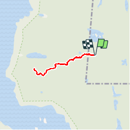
Trail Walking of 4.3 km to be discovered at Quebec, Les Laurentides, La Minerve. This trail is proposed by Alizée.pee.
Description
Randonnée qui suit le sentier « Caroline » jusqu’au Mont Weskarini qui permet d’avoir une magnifique vue sur le lac Gagnon. Randonnée avec un faible dénivelé.
Positioning
Country:
Canada
Region :
Quebec
Department/Province :
Les Laurentides
Municipality :
La Minerve
Location:
Unknown
Start:(Dec)
Start:(UTM)
493304 ; 5106276 (18T) N.
Comments
Trails nearby